


24 km | 42 km-effort
![Trail On foot Cangas de Onís - [TRC-002 R1] Ruta del Puentón - Photo](https://media.geolcdn.com/t/1900/400/ext.pjpeg?maxdim=2&url=https%3A%2F%2Fmedia.geolcdn.com%2Ff%2F1f0fd472-7a6b-4c8c-8c36-b5bd5597f427.jpeg)

Tous les sentiers balisés d’Europe GUIDE+


FREE GPS app for hiking
 SityTrail
IGN / Geographical institutes
SityTrail World
The world is yours!
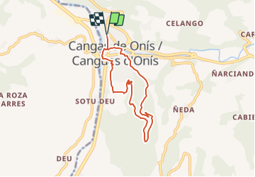
Trail On foot of 6.8 km to be discovered at Asturias, Asturias, Cangas de Onís. This trail is proposed by SityTrail - itinéraires balisés pédestres.
Website: https://www.cangasdeonis.es/centro-permanente-de-trail-running
![Trail On foot Cangas de Onís - [TRC-002 R1] Ruta del Puentón - Photo 1](https://media.geolcdn.com/t/2048/auto/cb0151b5-64fd-42a5-bbce-eafb36b5accd.jpeg&format=jpg&maxdim=0 "Trail On foot Cangas de Onís - [TRC-002 R1] Ruta del Puentón - Photo 1")
![Trail On foot Cangas de Onís - [TRC-002 R1] Ruta del Puentón - Photo 2](https://media.geolcdn.com/t/2048/auto/64278362-b20e-4ca4-89e0-59de12349e6a.jpeg&format=jpg&maxdim=0 "Trail On foot Cangas de Onís - [TRC-002 R1] Ruta del Puentón - Photo 2")
![Trail On foot Cangas de Onís - [TRC-002 R1] Ruta del Puentón - Photo 3](https://media.geolcdn.com/t/2048/auto/b31c0312-aede-4650-abb1-ee69e57d09a7.jpeg&format=jpg&maxdim=0 "Trail On foot Cangas de Onís - [TRC-002 R1] Ruta del Puentón - Photo 3")
![Trail On foot Cangas de Onís - [TRC-002 R1] Ruta del Puentón - Photo 4](https://media.geolcdn.com/t/2048/auto/0befab77-fdb7-42be-a335-67c956cbe66c.jpeg&format=jpg&maxdim=0 "Trail On foot Cangas de Onís - [TRC-002 R1] Ruta del Puentón - Photo 4")
![Trail On foot Cangas de Onís - [TRC-002 R1] Ruta del Puentón - Photo 5](https://media.geolcdn.com/t/2048/auto/d40344fc-c242-44ed-8768-87b328829403.jpeg&format=jpg&maxdim=0 "Trail On foot Cangas de Onís - [TRC-002 R1] Ruta del Puentón - Photo 5")
![Trail On foot Cangas de Onís - [TRC-002 R1] Ruta del Puentón - Photo 6](https://media.geolcdn.com/t/2048/auto/39e55e62-8dea-402d-b5fe-96e72676fde8.jpeg&format=jpg&maxdim=0 "Trail On foot Cangas de Onís - [TRC-002 R1] Ruta del Puentón - Photo 6")
![Trail On foot Cangas de Onís - [TRC-002 R1] Ruta del Puentón - Photo 7](https://media.geolcdn.com/t/2048/auto/fe4f4fa9-1180-4cee-b460-fccf4dcdaf00.jpeg&format=jpg&maxdim=0 "Trail On foot Cangas de Onís - [TRC-002 R1] Ruta del Puentón - Photo 7")
![Trail On foot Cangas de Onís - [TRC-002 R1] Ruta del Puentón - Photo 8](https://media.geolcdn.com/t/2048/auto/92e20d5d-462a-425d-aa1c-75c8be01e2e4.jpeg&format=jpg&maxdim=0 "Trail On foot Cangas de Onís - [TRC-002 R1] Ruta del Puentón - Photo 8")
![Trail On foot Cangas de Onís - [TRC-002 R1] Ruta del Puentón - Photo 9](https://media.geolcdn.com/t/2048/auto/0ebdad59-fbdf-4f29-9a19-03b092f881e7.jpeg&format=jpg&maxdim=0 "Trail On foot Cangas de Onís - [TRC-002 R1] Ruta del Puentón - Photo 9")
![Trail On foot Cangas de Onís - [TRC-002 R1] Ruta del Puentón - Photo 10](https://media.geolcdn.com/t/2048/auto/1f0fd472-7a6b-4c8c-8c36-b5bd5597f427.jpeg&format=jpg&maxdim=0 "Trail On foot Cangas de Onís - [TRC-002 R1] Ruta del Puentón - Photo 10")
![Trail On foot Cangas de Onís - [TRC-002 R3] Ruta del Rey Pelayo - Photo](https://media.geolcdn.com/t/375/260/ext.jpg?maxdim=2&url=https%3A%2F%2Fmedia.geolcdn.com%2Ff%2Ff65b4fbb-0b71-47f6-9620-4d57c9854fa2.jpeg)
On foot
![Trail On foot Cangas de Onís - [TRC-002 R2] Ruta del Rey Favila - Photo](https://media.geolcdn.com/t/375/260/ext.jpg?maxdim=2&url=https%3A%2F%2Fmedia.geolcdn.com%2Ff%2Fba158dcb-dfe0-4b5b-a168-1a9b2d3f986a.jpeg)
On foot

Walking